This is the sixth installment on a series of posts comparing Idaho's any-weapon, antlered, general season elk hunts. For an intro to this series, go here.
For the first post in this series, read Dworshak Elk Zone vs. Bear River Elk Zone.
For the second post in this series, read Snake River Elk Zone vs. Palisades Elk Zone.
For the third post in this series, read Palouse Elk Zone vs. McCall Elk Zone.
For the fourth post in this series, read Selway Elk Zone vs. Salmon Elk Zone.
For the fifth post in this series, read Panhandle Elk Zone vs.Tex Creek Elk Zone.
Here we go comparing the Middle Fork Elk Zone to the Dworshak Elk Zone. First up, the The Middle Fork.
The Hunt
The season dates for the general season elk hunts in the Middle Fork Zone (Units 20A, 26, and 27) are pretty exciting. Like the Selway Zone, there is an early season when the bulls are dead in the middle of their rut. In 2011, you had to choose between the A-tag or the B-tag.
 The A-tag ran from Oct. 1 - Oct. 31, and was any antlered elk in Units 20A & 26. In Unit 27, only brow-tined bulls may have been harvested. There were only 647 tags available for this hunt, and they went on sale as a first-come-first-served basis, first for non-residents on 12/1/10 and for residents on 7/10/11.
The B-tag ran from Sep. 15 - Sep. 30, and the rules were the same as described above for the A-tag: any antlered bull in Units 20A & 26, and brow-tined only in Unit 27. The B-tag also had a second season, Nov. 1 - Nov. 18, with the same rules as above. 1,636 B-tags was the quota, and they were first-come-first-served as described above.
Location
The Middle Fork Zone sits sandwiched between the Selway Wilderness on the north, the Salmon Elk Zone on the east, the Sawtooth Elk Zone to the south, and the McCall Elk Zone on the west. This is primitive Idaho at its finest. Wanting to get away from it all? This is big and wild country, and it rivals
 the Selway Elk Zone in that regard. 36% of the Zone lies within the Frank Church - River of No Return Wilderness.

Access to the Zone is limited. While it is not all designated wilderness area, roads are not plenteous going in or out. You can access the area by going through Yellowpine or Challis, and a few other places on Forest Service roads. But a big part of planning to go hunt the Middle Fork Zone is determining where you want to go, and how to get in and out. Most folks will suggest horses, at least. Flying in is also an option, along with choosing the right guide and/or outfitter. Backpacking in is also an option, but, as we shall see shortly, this is rugged territory.
Terrain/Land Ownership
The terrain is mountainous. River bottoms will be found at 4,000 - 4,500 ft. in elevation, and mountain tops will easily peak out above 9,000 ft. I would say that the average draw to ridgetop elevations will be between 6,000 ft. to
8,000 ft., and it is mostly ridge after ridge after ridge of the same beautiful, remote country, over and over again. Bring a compass. You will feel small.
8,000 ft., and it is mostly ridge after ridge after ridge of the same beautiful, remote country, over and over again. Bring a compass. You will feel small.
 As I said earlier, a big chunk (36%) of the Zone is wilderness. The remainder is USFS. There is virtually no private ground here, and very little of it is used for livestock grazing. Once you get in, the only thing limiting where or how you hunt will be your own legs (or your horse's). But don't let me scare you off entirely. This hunt is doable, and exciting. It offers hunts during the peak of the rut, but you must be able to track down that bull that you heard bugle over the next ridge. It's tough, but for the guys who are in good shape, the terrain can be more of a
The Zone consists of 1,846,323 acres, or 2,885 square miles.
Heard Health/Stats
 Earlier in the 20th Century, elk were not very numerous here. It wasn't until the 1970's that the elk population really took off and established itself. The population continued to grow until about 10-15 years ago. Many will point out immediately that wolf introduction happened at about the same time. This is true, and the wolves definitely have had an impact on the heard health. But habitat is just as much, and probably much more, of a factor.
Fire suppression management is the big one. The Forest Service manages virtually 100% of this Zone, so they are the ones to blame one way or another. As we all know, forest fires produce excellent elk habitat. Efforts to minimize the fires hurt the elk habitat. Specifically in this Zone, elk populations have risen and fallen in direct parallel to fire activity.
Units 20A & 26 have seen their elk herds decrease dramatically in the last 10-15 years, but Unit 27 hasn't been as drastic. Herds there increased up until 8-10 years ago, and since then there has been a steady decrease. In Unit 27, bull to cow ratios are very low, and this has been a result of poor calf production. Yes, the habitat is a big issue, but the observed herd health in Unit 27 shows that predators are taking a toll as well.
 Black bear numbers are low and steady. Mountain lion populations are high. Wolves are well established. IF&G managers see the wolves as being potentially very helpful to the herd's health by keeping elk populations below habitat capacity. But that's not a point you'd want to try to prove at the bar in Challis while talking with other hunters. It's debatable. On the issue of wolves, I believe the truth is somewhere in the middle. The wolves are hurting the elk, no doubt. But there is a perfect storm right now of decreasing habitat and increasing wolves. The ideal, for the hunter, is increasing habitat and decreasing wolves - obviously.
Objectives are to maintain between 3,850 - 5,750 cows, 950 - 1,550 bulls (of which 600 - 900 should be mature bulls). The 2006 survey counted 5,137 cows, and 834 bulls (of which 450 were mature bulls). 2010 was the last year that anterless elk hunts were conducted in the Zone. But antleress harvests were minimal, and it had no significant impact on the herd health. The main
 objective is to increase cows in Units 20A and 26, and to increase bull numbers in all of the Zone.

Here's the stats. 2006 survey data was used, and I have little doubt that the population levels have decreased since then. 2010 data was used for the harvest records. So the stats below are probably a little optimistic, but well within reason.
Elk/Square Mile: 2.0
Hunters/Square Mile: 0.4
Bulls/Square Mile: 0.29
Average Hunter Days: 5.9
Bull Harvest Percentage: 13%
Percent Spikes Harvested: 5%
Percent 6+ points Harvested: 57%
Dworshak Elk Zone
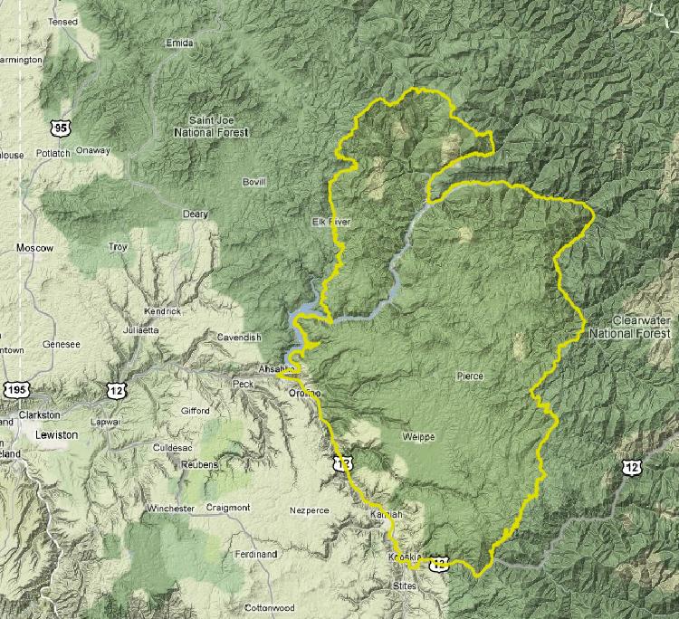
I've described the Dworshak Elk Zone here. So go there and read about it, and then come back here to see which Zone I think gives you the better chance at harvesting a bull.
Analysis & The Winner
Elk per square mile is basically the same for both the Dworshak and the Middle Fork. Hunters per square mile is much different, however. There is considerably less pressure in the Middle Fork's remote wilderness, with 0.4 hunters per square mile there compared to 1.4 in the Dworshak Zone. Bulls per square mile is similar between the two Zones, with Dworhak only being slightly higher.
The kinds of bulls harvested finds the two Zones on opposite ends, and much of that has to do with the brow-tined only restrictions in Unit 27. In the Middle Fork, 5% of the harvest is spikes, while 57% are 6-pointers or better. In the Dworshak Zone, 42% are spikes, while only 15% have six points or better. In the end, however, the bottom line stat is this. In the Middle Fork, you have a 13% chance of filling your tag, while in the Dworshak Zone, that decreases to 7%.
Bull numbers are down in both Zones. But the odds of you finding a really decent one reside in the Middle Fork. The Middle Fork's terrain is certainly more difficult to hunt in, but on the other hand, it offers a lot more glassing/spot and stalk opportunities.
In the end, as difficult as it may be to get into the Middle Fork's wilderness, the odds of harvesting a bull are greater there. The vistas are rewarding too. And if you make an elk trip there, I'm certain it will be an adventure to remember. Middle Fork Elk Zone is the winner!